
Spatial Equity Vol. 2 Has Been Released!
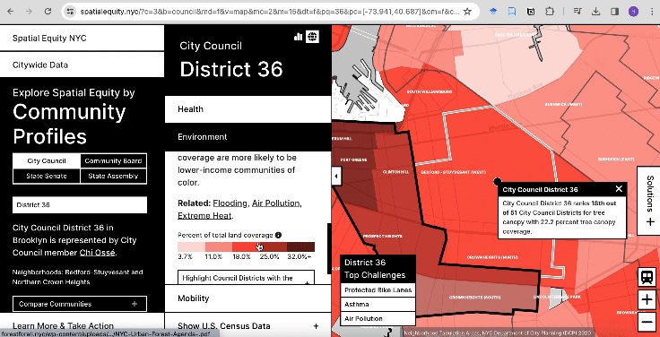
We are excited to announce the release of the second version of Spatial Equity NYC. Spatial Equity NYC is an online data tool, developed in collaboration with Transportation Alternatives, that helps visualize the impacts on various aspects of urban living including mobility, public health, and the environment that have been impacted by past car-centric planning policies. This tool was developed in hopes of bridging the gap between planning and public professionals and the public by making access to pertinent data not only accessible, but easy to understand. The first version of Spatial Equity NYC was released 2021 and was quickly integrated into the work taken on by various public officials in New York City at various levels of government. The second version expands on this original version with 24 layers of information, including new layers for flooding and public seating; and the ability to map data at the State Assembly and State Senate District level for the first time!
We want to congratulate our Spatial Equity team, led by LCAU Director Sarah Williams and project lead Hannah Shumway, including Adi Kupershimdt, Linh Nguyen, Enrique Casillas, and Sebastian Ives.
Feel free to click around the tool yourself and discover interesting information about mobility, public health and the environment of New York City.