
Turning Crowdsourced Streetscapes into Digital Twins
Team: Carlo Ratti (PI), Director, Senseable Cities Lab and Professor of Practice; Fabio Duarte (PI), MIT DUSP Associate Director of the Senseable Cities Lab, and Lecturer of Technology and Urban Planning; Nikita Klimenko; and Umberto Fugiglando, Senseable Cities Research Manager and Partnerships Lead.
Summary: Our project aims to address the growing issue of extreme heat in cities caused by climate change. Traditional methods of predicting urban heat rely on complex and resource-intensive simulations that often fail to capture the intricate details of urban environments, such as varied building materials, vegetation, and human activity.
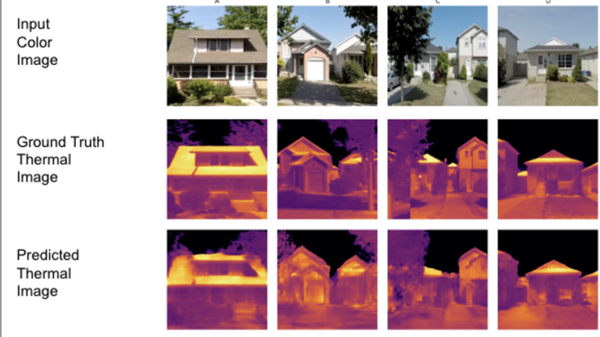
We propose a new approach that uses open-source imagery from platforms like Google Street View to predict urban heat levels. By employing advanced computer vision and deep learning techniques, we can transform these street images into detailed 3D models that accurately reflect the heat dynamics of urban streetscapes. This method simplifies the process, reducing the need for extensive data collection and complex modeling, and making it accessible to more cities and organizations. It allows urban planners to identify heat-vulnerable areas and develop strategies to mitigate the effects of extreme heat more effectively. Ultimately, our project seeks to revolutionize urban heat prediction by providing an innovative, cost-effective, and scalable solution to enhance the livability and resilience of cities in the face of climate change.
“Receiving this funding will allow us to contribute to the field of urban climatology by improving urban heat prediction using advanced deep learning and open-source imagery. This support will help make thermal modeling more accessible and scalable, enhancing urban resilience to extreme heat.”